Undeniably, African leaders are confronted with challenges of rapid socioeconomic development in spite of the rich human and natural resources which abound more than commercial requirements across their states; this unpalatable situation results because of paucity of requisite data to support good decision-making, effective planning and implementation of socioeconomic policies and projects that may give life to the weak substructure that characterizes African economies.
Hence geospatial information or the products of surveying and mapping have become consequential to good governance and achievement of the supplant of the Millennium Development Goals (MDGs), that is – the Sustainable Development Goals (SDGs), the Governing Council on the African Regional Institute for Geospatial Information, Science and Technology (AFRIGIST) is planning to bring together Surveyors General of African countries to brainstorm towards ensuring the availability of requisite and timely geospatial data to impact good governance.
Chairman of the council, Mallam Mahamodou Keita who was with the Surveyor General of the Federation (SGoF), Surv. Samuel Adeniran Taiwo as the First Representative of the Nigerian Government on the council and AFRIGIST Executive Director, Dr. Akingbade Adewale Olusola hinted on this during a courtesy call on the Oni of Ife, Oba Adeyeye Ogunwusi Ojaja ll in Ile Ife, Osun State. He said the governing council said AFRIGIST would continue to build capacities needed to change the narrative in Africa for appropriate and sustainable development.
While on courtesy call to the Government of Osun State, the SGoF, Surv. Taiwo advised officials of the state government led by the Deputy Governor, Mr. Benedict Olugbenga on the importance of geospatial data in decision-making, planning and implementation. He disclosed that it was the realization of the relevance of geospatial data or the peerless effect of the products of surveying and mapping to issues of development generally that informed the upgrading of the Department of Federal Surveys to an Extra-Ministerial Office under the supervision of the Honourable Minister of Works and Housing.
Development of physical structures must be supported by data, appropriate data set. No amount of money you spend on Geospatial Information is much”, he said. Surv. Taiwo observed that that were three of Continuously Operating Reference Station (CORS) in Osun. While commending them for this, he encouraged the government to increase the numbers noting that it would help in streaming geospatial data and production of digital maps from places around the CORS, which would in turn upscale the internally generated revenue of the state.
He urged the state government to upgrade the status of the state surveyor general to permanent secretary for some obvious reasons in view of the importance of the surveying and mapping activities.
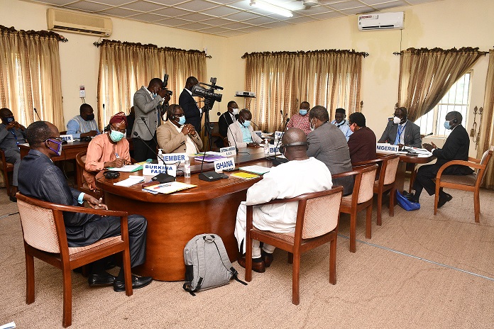
Already the 51st meeting of the governing council has commenced at AFRIGIST situated at the Obafemi Awolowo University (OAU), Ile Ife in Osun with Mallam Keita, representing the Government of Mali presiding over the series of meetings from which various decisions which would impact on the training in Geospatial Information, Science and Technology relating to land and the space as well as governance would be taken.
Signed:
Abu, I. Michael
Head of Press and Public Relations, OSGoF


