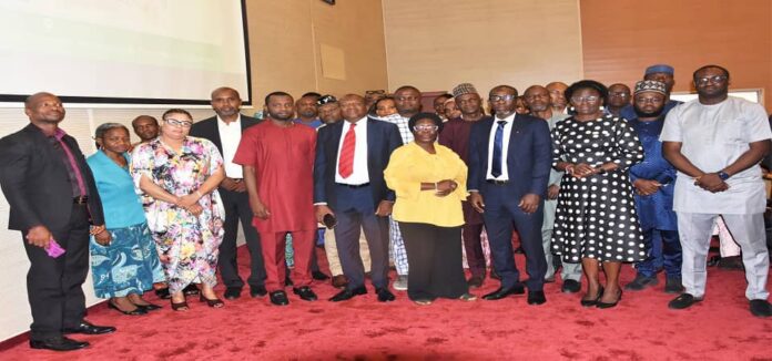
….Sensitizes relevant Government Ministries, Departments and Agencies on Implementations
The Honourable Minister of State, Budget and National Planning, Prince Clem Ikanade Agba, has promised that the federal government will leverage on Geospatial technology for economic growth and development of the country.
He made the promise on Tuesday during a sensitization workshop for some Ministries, Department and Agencies, MDAs of government on the use of geospatial data for development planning and decision making at the Auditorium, Federal Ministry of Finance, Budget and National Planning Headquarters, Abuja.
Agba who was ably represented by the Senior Assistant to the Minister Dr Zakari Lawal MNI, said that the workshop will enhance the capacities of the participants to analyse and visualize geospatial data to support the planning and service delivery of programme under the National Poverty Reduction with Growth Strategy (NPRGS) and the National Development Plan (NDP), 2021-2025.
According to the Minister, the initiative was embraced by the federal government in recognition of the importance of geospatial information in providing real-world and real-time insights on development challenges leading to better and evidence-based decision-making by Governments globally.
Agba stated that apart from providing geographic information about the country in terms of asset and potential, Geospatial technology will also support individuals’ efforts to the development of Nigeria.
He informed that the use of geospatial data has now become vital and central to any development effort across the world, as it is recognized as global best practice in Monitoring and Evaluation of government programs, projects and policies, hence, the introduction of the initiative for the benefits of all citizens of the country.
The Minister maintained that the institutionalization of the use of spatial evidence to support decision making in the Federal MDAs is one of the key strategies enshrined in the National Monitoring and Evaluation Policy.
Agba disclosed that the Ministry has applied the use of Geospatial technology in planning and performance management of some Federal Government projects, adding that the Ministry is currently supporting sub-national governments to uptake the use of Geospatial technology and planning and project delivery especially in equitable distribution of infrastructure, education and health services, considering issues around population demography such as gender and other vulnerabilities.
He also noted that Geospatial technology has been applied into some key innovations such as Eyemark project of the Ministry and School Placement Optimization Tool (SPOT) at Universal Basic Education Commission (UBEC), and it is also central to the Management Information System/Geographical Information System (MIS/GIS) implementation in the Ministry.
Delivering his Opening Remarks at the event, the Permanent Secretary, Budget and National Planning, Federal Ministry of Finance, Budget and National Planning, Engr. Nebeolisa Anako, who was represented by the Acting Director , Monitoring and Evaluation Department, Mrs Olasumbo Yakub, informed participants at the workshop that Geospatial Technology which includes Geographical Information System (GIS), Remote Sensing (RS) and Global Positioning systems, Global Positioning System (GPS), will enable institutions to acquire data referenced to the earth for analysis, modelling, simulations and visualization.
According to him, geospatial information system provides the platform for handling spatially referenced information and allows for the integration of datasets from different sources.
He noted that Geospatial data has been applied in several value adding services such as street maps and geo-specific advertising, stressing that at the Federal level, geo spatial data has been applied in the design and delivery of key social investment programmes.
The Permanent Secretary stated that geospatial data remains vital and necessary element for achieving any development, be it in disaster management, agriculture, construction of houses, bridges, dams, health, water, roads and transportation system.
Engr. Anako called on participants to take the workshop very seriously because of the centrality of Geospatial technology to Nigeria’s efforts to achieving economic growth and development in order to be at par with developed countries across the globe.
The workshop participants were drawn from eighteen (18) Federal Ministries and forty-six (46) agencies whose mandates addresses Human Capital, Regional and Social Development; Economic Inclusion, Planning and Public Administration; Infrastructure and Environmental Services.
The following papers were presented during the workshop; Guidelines for Establishing Capacities to produce, analyse and utilise Geospatial information for Development Planning and Decision Making by the Office of Surveyor General of the Federation; Applying Geo-referenced population data in Designing and Planning Federal Government programme and project by Mrs. Foluke Y. Adebayo, Director, Data Quality Management.
Other topics treated are: Developing Geospatial applications, use-cases and tools that support evidence-based development planning and decision making by the Representative of the DG National Space Research and Development Agency; the role of Mobile and Geo-Spatial information in the delivery of Federal Government Programmes – The NASSCO Experience by Sesugh Nongo, MIS Manager, National Social Safety-Nets Coordinating Office; and Overview of the GRID3 Nigeria Project/School Placement Optimisation tool by Mr. Nazir Halliru, GRID3 Country Manager.
Olude Omolade (Mrs)
Principal Information Officer
For: Director, Information(BNP)


