There is no denying the fact that Nigerians are going through hard times. However, with little patient, I am certain that the people in no distant time will celebrate victory over the country’s socioeconomic misfortunes. Going by the commitment of the incumbent Administration of Muhammadu Buhari towards averting the ugly situations of things in the country, like they say, “there is light at the end of the tunnel” The National Bureau of Statistics (NBS) recently announced that the Nigeria’s Gross Domestic Product (GDP) grew by 4.03 percent in real terms in the 3rd Quarter of 2021 and that the progress was sustained over the last quarters of 2020. NBS attributed the growth to the non-oil sectors. It is an impressive feat considering the energy put into the economic diversification efforts by the government.
In its further quest to squarely tackle the manifold of the challenges bedeviling the economic, social, political and cultural lives in Nigeria, the Federal Government took some critical steps like setting the nine areas of priority and the broad agenda of Security, Economic and Anti-Corruption (SEA). It developed a frame, the Economic Recovery and Growth Plan (ERGP) that will expire by December 2021. In place of the ERGP, the Federal Executive Council (FEC) has approved a five year National Development Plan (NDP) targeting N348.7 trillion investments. According to the Minister of Finance, Dr. Zainab Ahmed, the focus would be for economic growth and development, infrastructure, public administration, human capital and social development.
To avoid leakages of funds, wastes and unhealthy intermissions according to the minister, there would be a Development Plan Implementation Unit (DPIU) that would be reporting to the National Steering Committee headed by the Nigerian Vice President to ensure a strong mechanism and framework to promote good performance and accountability in various processes necessary for implementing the plan.
Reading “The view from America” by Dr. Chido Nwangwu (What Nigeria and Africa can learn from America’s Infrastructure Agenda) published by www.thisdaylive.com, Friday, November 12, 2021, I discovered that the United States of America has taken this path when its House of Representatives approved the Bipartisan Infrastructure (BIF) legislation on November 5, 2021. The USA’s BIF is a $1.2 trillion Infrastructure Investment and Jobs Act’ H.R.3684. It focuses on investments and spending on rood and technology highways, transit and rail networks, energy, climate change issues among others. The Nigerian Government is therefore on course, and needs all the support to ensure huge success on the projects for the NDP.
However, the government must not lose sight of the limitations of the Millennium Development Goals (MDGs) because the framework lacks integration of Geospatial Data. After a critical review, the UN came up with 17 Sustainable Development Goals (SDGs) projected to propel countries to far-reaching development through effective management of the social, economic and environmental situations impacting the people. Integrated into the SDGs framework as a global policy guide, policy and project implementers in the country must ensure to mainstream Geospatial Data. For the new 5-year NDP to sufficiently yield positive fruits or impact the economy, the mainstreaming of Geospatial Data is consequential.
The geographical space or area making up a country is majorly defined by land. Apart from the unquantifiable inherent riches in the land, it provides the substructure for every successful human endeavor such as construction, building and manufacturing works; food production among many others. Man is destined to conquer his environment, but not without the application of technological and scientific knowledge using requisite Geospatial Data. Many challenges of man are largely geographic in nature, and as such there is hardly any success in human endeavours that can be recorded with geospatial inputs.
With Geospatial Data, issues of sustainable development can be analyzed, modeled and mapped to provide quick and reliable the basis for Evidence-Based Decision-Making, implementation and execution of policies, projects and programmes of the government which will in turn translate into robust socioeconomic system for better conditions of living. The Office of the Surveyor General of the Federation (OSGoF), the apex surveying and mapping Office of the country should as a matter of relevance be part of DPIU for efficient and effective implementation of the NDP.
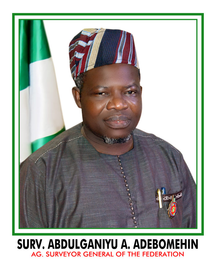
During the inspection of the OSGoF’s High Performance Data Centre, the Acting Surveyor General of the Federation (SGoF), Surv. Abduganiyu Adeyemi Adebomehin did reiterate that the Office is a solution provider and that it has the capacity humanly and technologically speaking to support MDAs toward achieving their mandate, including the people-oriented projects of the government.
Abu, I. Michael is the Head of Press and Public Relations, OSGoF


