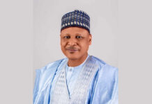
After all the political hubbub, though with various challenges still in the Presidential Election Petition Tribunal by some aggrieved contestants of the 2023 Presidential Election, Nigerians have every reason to celebrate the dawn of a new government, another democratic dispensation under the leadership of His Excellency, Asiwaju Ahmed Bola Tinubu as President and Commander-in-Chief of the Armed Forces alongside his Vice, His Excellency, Shettima Kashim. Both of them performed tremendously as Governors of Lagos and Borno States respectively; their antecedents are on records.
As governor from 1999 – 2007, President Tinubu could be said to have laid the foundation for the symmetrical development of Lagos State because of his leadership competency and deep insight of geospatial dynamism. That is why the development plan of Lagos State was well structured and infrastructural distribution and expansion inimitably tackling rowdiness, insecurity and enforcing steady growth in state Internally Generated Revenue (IGR); subsequent governors of the state tow this path making Lagos State to be a pacesetter not only in the country but in the West African sub-region socioeconomically and in terms of physical infrastructure. The leadership ideal ingrained by his governorship engendered robust state of security for every sector to thrive.
Security is a major area of focus for any government. Way back as a student of Political Science at the Yobe State University, we transmit much of these words: ‘state’, ‘government’, ‘sovereignty’, ‘territory’, ‘population’ and ‘power’ in the class hence they became some of our companionate vocab as students. Unfortunately, having spent nearly 4 years of the programme which I started from Pre-Degree, I was unable to complete it like other sad experiences because of the pervasive insecurity occasioned by the Boko Haram insurgency that heavily wrecked normalcy in Yobe State, Borno and especially some other states of the northeast as at that time. A peaceful atmosphere is not only priceless, but sacrosanct as necessary condition for societal growth and development as well as its survival as an entity.
Unarguably, states lose their socioeconomic glow; precious human lives are also threatened apart from various destruction when the tranquility of a political state is infringed upon. No country in the world can practically make headway politically, socially and economically in the face of public disorder and insecurity in general. The Nigerian State has over the years been challenged to appreciate geospatial dynamism not only in terms of socioeconomic and physical development but in peace enforcement and general protection.
Just like any other countries in the world, Nigeria is defined by the features of political state such as territory, population, government and sovereignty. Even though the government is an agency of the state, it remains critical because it is the body constitutionally empowered to govern the affairs of a country. In our contemporary world, no country can survive and progress without the application of geospatial data because we exist within a geographical sphere; this is what President Tinubu-led Government must take to heart and ensure that public institutions apply geospatial techniques in their operations in order to save cost and speedily achieve results. Just to refresh our memories, a country is confined within a geographical area called territory and usually consists of people (population) and it is the workings of the government to uphold its sovereignty, the supremacy of that country within its territorial area. The Nigerian Government and especially, the President and Commander-in-Chief of the Armed Forces must have at all times prototypical of the territory he controls and all that is therein.
Recently, some officials of the Civil Society Coalition for Transparency and Good Governance had very robust interaction with the Surveyor General of the Federation (SGoF), Surv. Abuduganiyu Adeyemi Adebomehin at the Survey House, Abuja; the conversation was stimulated by a patriotic zeal to ensure that Nigeria is routed in the glorious path of equability, increased physical infrastructure, sustainable socioeconomic development and also more importantly, solid national security arrangement.
Having taken critical assessment of the functions and statutory mandates of the Office of the Surveyor General of the Federation (OSGoF), the officials of the coalition lost breath in the realization that Nigeria has such an organization with its functions essentially prime to national security and all other sectors of the economy. They deemed it fit to take it upon them to advocate adequate budgetary allocations for OSGoF, and also warrant aggressive campaigns and sensitization in order abreast the general public on the significance of geospatial data and streamlining of geospatial inputs in planning and implementation of projects by the Nigerian Government and its MDAs.
Another crucial issue that the coalition is intervening is for the government to urgently make funds available for the review of the Survey Coordination Act (SCA) enacted since 1962. The strength of the provisions of the act is already hampered by the contemporary realities hence there have been recorded cases of proliferation of maps and violations of the act endangering our national security, physical planning and project implementation.
The government must also ensure we fully harness and streamline geospatial inputs in our public enterprises, the apex surveying and mapping office of the country should be seen very much as part of the Defence and National Security Architecture, National Planning and Implementation. Patriotically speaking, the Office of the Surveyor General of the Federation (OSGoF) should be properly situated to free it from bureaucratic bottlenecks for robust funding and operations that would at all times ensure urgent decisions and actions on matters of national concerns.
President Tinubu in his inaugural address on May 29 mentioned some key areas of the focus of his administration which includes security, the economy, job creation and agriculture among others. These and other challenges of our environments can only be dealt with more appropriately if the generation and application of geospatial data is entrenched in the heart of every governmental decision, planning, programming and implementation.
By Abu, I. Michael
Michael is the Head, Press and Public Relations, OSGo


