…………….“Nigeria has joined the smart cities in the world under the Renewed Hope Agenda of Mr President” – Surveyor General of the Federation.”
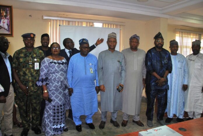
The Office of the Surveyor General of the Federation (OSGoF) has held a workshop on “The Use Cases for the Very-High resolution Drone Imagery and Street View Data Collected for Part of the Abuja Municipal Area Council (AMAC), FCT”, bringing together professionals and representatives of different MDAs to gain insights to the drone imagery and street view data captured in 3D to promote the impact of geospatial and surveying in Nigeria.
Presenting his welcome address, the Surveyor General of the Federation (SGOF), Surv. Abuduganiyu Adeyemi Adebomehin emphasized the importance of leveraging the data of the 3D digital twin mapping of Abuja for national transformation, economic planning and sustainable development. He said “we should all be proud of what we are going to see now. It was a bit difficult at the initial phase but we overcame. When you refer to geospatial, information and management and you refer to technology, which is what is shaping the world now; Smart cities and the likes in this point of discourse come into play as a result of this development of this innovative idea. I want to appreciate The PLACE who sent their expert teams who have been in charge of this 3D drone mapping”.
He highlighted the importance of the digital mapping and street view data collection in relations the achievements of the Renewed Hope Agenda of the Federal government of Nigeria. He reiterated the support of the Minister of Housing and Urban Development of Nigeria, Arc. Ahmed Musa Dangiwa for swift approval in executing the task. He added that “it is a new technology and truly, first of its kind in Africa. If we fail to move with trends in technologies, Nigeria will not be part of the smart cities. When you talk about of the Smart City, the 3D drone mapping is the driver of such. I want to appreciate the Place, the American government and the United Nation”.
“So, I just wanted to note that in shaping the world now, it is the geospatial management and the information that you are able to manage that is shaping the world. And we don’t want Nigeria to be left behind. That is why we have to go all out of our way, looking at the achievements of this government, So, I want to say this is one of the achievements of the Renew Hope Agenda of Mr President “ Adebomehin remarked.
In his presentation on “Use Cases for the Very Large-Scale Drone Imagery of AMAC”, the Head of Photogrammetry and Remote Sensing, Surv. Afeez Azeez stated that the Office of the Surveyor General of the Federation is the apex of mapping and surveying by providing accurate data for the Federal Republic of Nigeria to make informed decisions. He said “one of the main responsibilities of OSGoF is to carry out the National Topographical Mapping of the country at different scales. In order to achieve a very-high resolution mapping, drone imagery was needed”. To achieve this, he appreciated the Place in providing technical know-how support in executing the project.
Afeez highlighted the importance of keying into the digital twin mapping of FCT. He said “it will help create digital twin capturing of images in its real sense, it is the basis for smart cities and autonomous cars.
A “Smart City” is an urban area that uses technology to enhance the quality and efficiency of its services. The Large Scale Topographical map capturing started in the 2016 which captured building footprints. For a more advanced resolution of images, the Very-Large Scale was introduced to have in-depth information in real time. The resolution is up to about 5cm. That is the reason we partnered with The Place”.
Furthermore, he said “what we want to do with this high resolution drone imagery we have collected is to create a very large scale topographical map of the area at a scale of 1:1000. Secondly, it will enable us have the digital twin mapping. Digital twin is virtual representation of reality. Reality of man-made and natural features will be captured in their correct positions and represent them in their 3D coordinate in space (virtual world). OSGoF is just introducing that to Nigeria. It has never been done before”.
Head of Photogrammetry and Remote Sensing also said the areas of application of the Very Large-Scale spans across various levels namely; national planning, improved security, good governance, natural resources management, national population census and so on. He said “we have covered 20 blocks out of the 25 areas approved for digital mapping within the Abuja Metropolis.
In addition, the Geospatial Technical Lead of The Place, Mr. Waddah Hago in his presentation explained that they completed the drone imagery of a 152sq km area in just 10 days. The Place collaborated with OSGoF in training sessions and technical skills in order to continue with the collection of data. He said “a high resolution orthomosaic and AI was used in order to have a high resolution of the mapping; about 5cm accurate. The Place is a non-profit organization based with its headquarters in the United States. Their mission is to help map urban areas for the good of the public.
Stating the advantages to the country, he said “the digital twin map are for cities and can be applied in all ramifications, saves time and scarce resources not available in the country and buildings were captured in real time which estimates can be used for population census”.
The workshop underscored the necessity of innovation, inclusiveness, and sustained investment in the geospatial space to meet with the demands of the 21st century. The resolutions will guide future policies and initiatives, reinforcing the critical role of digital twin mapping and geospatial data in shaping Nigeria’s future.
Signed
Henry David
Head , Information and Public Relations
OSGOF
3RD April , 2025


